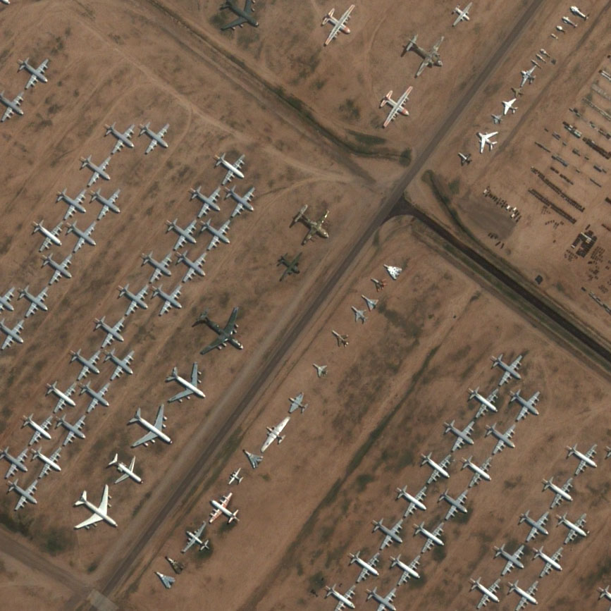
 There appear to be two non-government-owned companies providing satelite imagery: Space Imaging and upstart DigitalGlobe (yeah, like they’re not both upstarts). DigitalGlobe is working hard to make friends with the media and regularly offers timely images of events, disasters, and wars to them. For the public, they offer some more scenic shots, like this one of the the boneyard at Davis-Monthan AFB in Tucson, Arizona from August 11, 2002.
The boneyard serves as a holding place for out-of-rotation airplanes until their fate is decided; the dry, clear climate of Tucson provides an ideal environment for the storage of aircraft, as they can sit indefinitely without rusting. The hard, desert soil also makes for easy towing of the planes without the need for roads.
There’s a lot more in the sample gallery. Their Vatican gallery is the most recent addition.
DigitalGlobe’s QuickBird imaging satellite, launched in 2001, has 60-centimeter resolution in natural color and has 320 Mbps imagery downlink bandwidth. The imaging hardware (like that of Space Imaging’s IKONOS satellite) was designed and built by Kodak.
[update:] Here’s the airplane graveyard on Google Maps; here are some photos from ground level; tours are available.